| 21 | K1076
Vaarwaters en ankerplaatsen nabij de Kleine Soenda-Eilanden. Blad VI (Zuidkust Soembawa) - 265 |  | 
Maritiem Museum Rotterdam | |
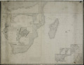
| 22 | K1363
Coast of the Cape Colony, Delagoa Bay & c., Madagascar, Bourbon, Mauritius &c. | |
Maritiem Museum Rotterdam | |
| 23 | K1364
A chart of the Indian Ocean and part of the Pacific Oceans; with particular plans of the harbours. (onderste deel van de kaart zonder titel) | |
Maritiem Museum Rotterdam | |
| 24 | K1365
A chart of the Indian Ocean and part of the Pacific Oceans; with particular plans of the harbours. (bovenzijde van de kaart, met titel) | |
Maritiem Museum Rotterdam | |
| 25 | K1370
The Island of Rodrigues - Plan of Port Louis - Isle of France or Mauritius - Plan of Port Bourbon with its entrances - The Island of Bourbon, or Ile de la Réunion. | |
Maritiem Museum Rotterdam | |
| 26 | K1376
New Hydrographical plan comprising the navigation from Bombay to Madras and Bengal. Shewing the situation of the principal towns and roads in the Carnatic and Mysore country. The Isle of Ceylon. &c. | |
Maritiem Museum Rotterdam | |
| 27 | K1379
Indian Ocean - 138 | |
Maritiem Museum Rotterdam | |
| 28 | K1380
Indian Ocean - 138 | |
Maritiem Museum Rotterdam | |
| 29 | K1381
Islands in the Indian Ocean - 1635 | |
Maritiem Museum Rotterdam | |
| 30 | K1386
A general Chart of the Indian and part of the Pacific Oceans showing the various passages to & from China, Australia's, New Zealand, &c. Carefully constructed & Compiled from the most approved observations and modern surveys, by J.S. Hobbs , F.R.G.S. Hydrographer 1850. London published as the Ac... | |
Maritiem Museum Rotterdam | |
| 31 | K1408
Strait of Malacca - Sheet I - From Diamond Pt. to the North Sands. - no. 1353. | |
Maritiem Museum Rotterdam | |
| 32 | K1409
Malacca Strait - Penang or Prince of Wales Island - no. 1366 | |
Maritiem Museum Rotterdam | |
| 33 | K1411
Indian Ocean - Ceylon south coast - 813 | |
Maritiem Museum Rotterdam | |
| 34 | K1412
Ceylon south coast - Point de Galle Harbour - 820 | |
Maritiem Museum Rotterdam | |
| 35 | K1413
Ceylon - S.W. coast - Approaches to Point de Galle Harbour including the Gindurah and Bellow Rocks - 819 | |
Maritiem Museum Rotterdam | |
| 36 | K1419
Westkust Sumatra - Singkel tot Padang en nabijliggende eilanden - 135 | |
Maritiem Museum Rotterdam | |
| 37 | K1427
Vaarwaters en ankerplaatsen op de westkust van Sumatra en nabijliggende eilanden. Blad V. (Sipora en Pageh-Eilanden) - 278 | |
Maritiem Museum Rotterdam | |
| 38 | K1428
Vaarwaters en ankerplaatsen op de westkust van Sumatra en nabijliggende eilanden. Blad V. - 278 | |
Maritiem Museum Rotterdam | |
| 39 | K1557-A
Eerste deel van de kaart van Azië met Arabië, Perzië en India (zuidelijk kaartblad) door J.B. Bourguignon d' Anville, 1751.Prémière partie de la carte d' Asie contenant la Turquie, l' Arabie, la Perse, l' Inde en deça du Gange et de la Tartarie ce qui est limitrophe de la Perse et de l' Inde. | |
Maritiem Museum Rotterdam | |
| 40 | K1557-B
Eerste deel van de kaart van Azië met Arabië, Perzië en India (noordelijk kaartblad) door J.B. Bourguignon d' Anville, 1751.Prémière partie de la carte d' Asie contenant la Turquie, l' Arabie, la Perse, l' Inde en deça du Gange et de la Tartarie ce qui est limitrophe de la Perse et de l' Inde. | |
Maritiem Museum Rotterdam | |